Our unique technology produces a Digital Twin that provides the most accurate understanding of the crop and the soil it grows in. When growers learn from our digital twin, they produce more and spend less on inputs.
Our digital twins enable agronomists, irrigators, and other farm managers to clearly and confidently understand how the crop performance and soil properties are related and influence one another based on plant genetics and management practices.
Built Upon Better Measurements of Crop and Soil
Digital Vegetation Signature ™
Calibrated Spectral and Spatial Indices
Zoom in to Plant Level
Estimates of Productivity and Health
See Changes Through Time
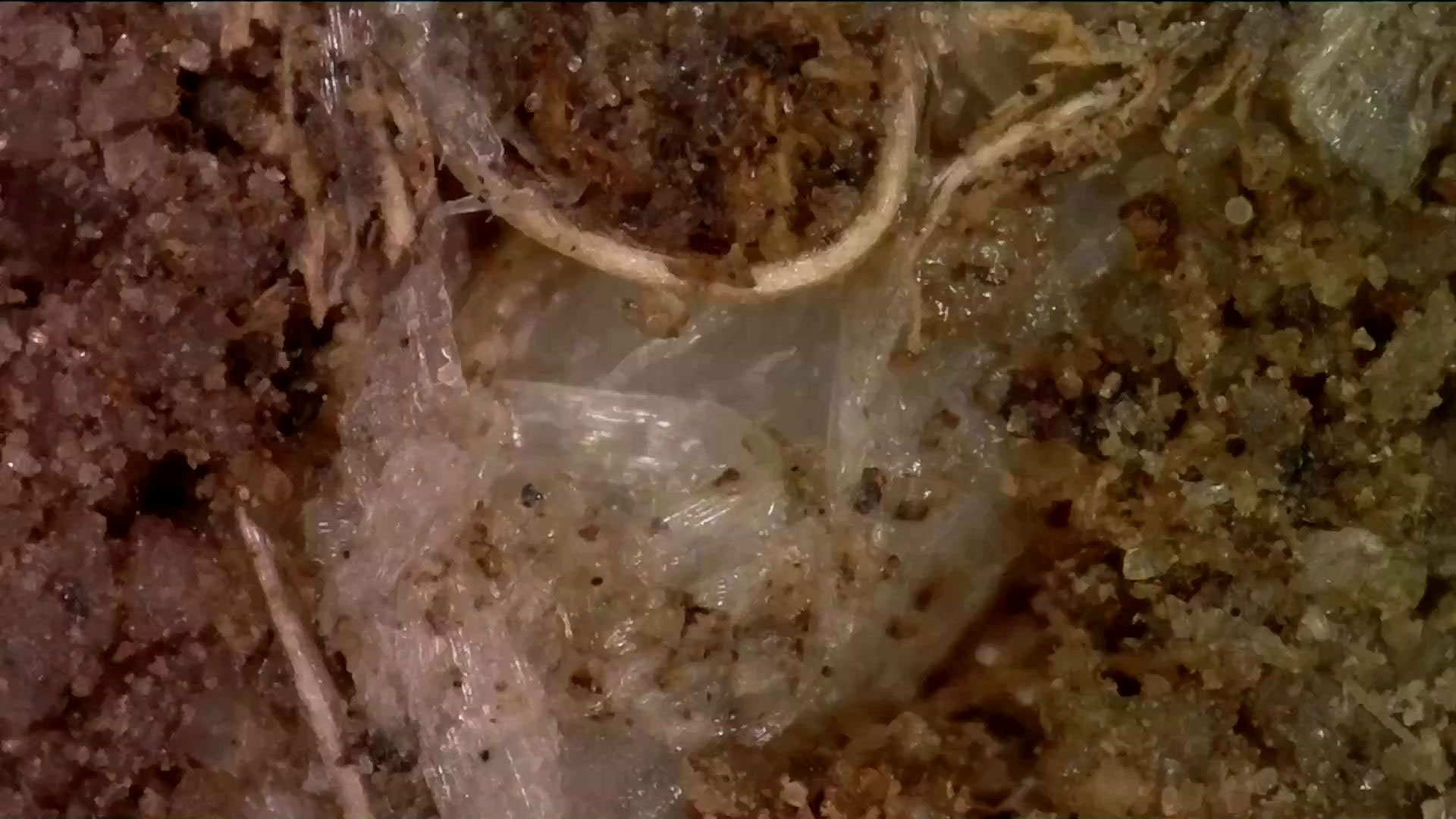
Digital Soil Core ™
See Soil Like Never Before
7 Sensors
3 Foot+ Deep Profiles
1000s of Data Points Every Inch
50 + Soil Properties
Full Profile Video
Like Having a Full Soil Texture and Fertility Analysis for Every Plant
Powered By
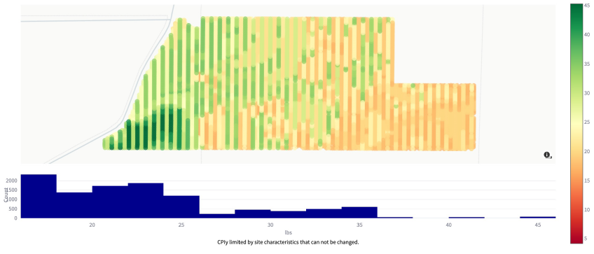
Root Cause Analytics ™
Empower your Digital Agronomy team to make practical and economically sensible decisions using our interactive Root Cause Analytics™ (RCA) software. RCA generates previously impossible custom and dynamic analytical insights to optimize inputs and maximize outputs while improving soil health and crop nutrition.
The LandScan team has been working together for decades providing services to farmers on 6 continents across thousands of fields growing all types of crops.