Company
Challenge
If you can measure it, then you can manage it. In agriculture, the ‘it’ you are dynamically managing is a combination of your product (the crop) and your most valuable asset (your land). But what do you measure? What can you measure and how do you measure it?
Advances in engineering, agronomy, and data science provide great promise for optimizing agricultural production, but without a thorough site characterization these tools cannot be deployed to their fullest capacity. Terms like precision management, variable rate technology, artificial intelligence, machine learning, and dynamic modeling are not fully enabled in agriculture without the creation of a digital twin. The field-scale digital twin is necessary in order to get to the next level of optimization in agriculture because it gives the manager many more measurements and enables continuous improvement.
Mission
What agriculture needs right now is a way to fully take advantage of these advances at the field-scale. LandScan has developed the only technology in the world that digitally synchronizes high resolution analytical quality vegetation sensing with unique in-situ digital soil profile scanning to create a digital twin of each agricultural field.
The resulting information infrastructure is used to perform revolutionary analytics that enable never-before possible insights and decision support for crop and land management.
Team
Our team comprises experts across many disciplines that invent, create, and deploy unique sensors and analytical tools for practical use in the real world. We are passionate and genuinely interested in our work and we see our mission as helpful to mankind and all living creatures. When we succeed the world is a better place. We are also the only team of people in the world who have envisioned, designed, built, commercialized, and deployed digital soil mapping and remote sensing technology on every continent (excluding Antarctica).
Our Amazing Team
Science and Technology Advisors
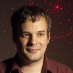
Patrick Brown, PhD
Dr. Brown is a Distinguished Professor at University of California, Davis and serves as an Advisor to LandScan in the areas of plant nutrition, plant physiology, technology development and application to optimize fertilizer use, and advanced harvesting systems in nut crops, citrus, and row crops.
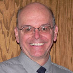
John Norman, PhD
Dr. Norman is a Fellow in the American Society of Agronomy and in the Crop Science of America, and is co-author of a widely used text entitled “Introduction to Environmental Biophysics”. He has published 203 refereed publications in the scientific literature in 57 different professional journals and books.
Sabine Grunwald, PhD
Dr. Grunwald is Scientific Advisor at Landscan and Professor at the University of Florida. She has research expertise in pedometrics, AI modeling, soil and landscape modeling, soil and terrestrial carbon assessment, digital soil mapping, proximal soil sensing, and geoscience applications. She is also a Fellow of the Soil Science Society of America.

