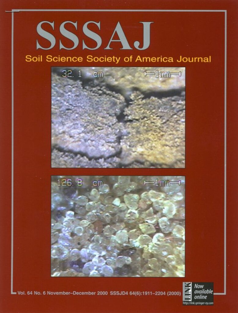
This was the cover of the Soil Science Society of America (SSSA) journal 25 years ago. It was a complete shock to see my PhD research at the University of Wisconsin-Madison on the cover of this important scientific journal.
It was then, and amazingly still is, a novel way of examining the soil profile in-situ. But building the tool (I called it the Soil Imaging Penetrometer then) wasn’t enough as I had to also perform original research. In one study I imaged all 409 Munsell color chips and converted the hue/value/chromo designation to red/green/blue color space then plotted them on 3 axes (imagine a box with all Munsell color classes floating inside all separated from each other). Then, I could convert the soil being imaged at any moment into the same color space and instantly calculate which of the 409 colors it was closest to (in Euclidian space) and also rank them from closest to farthest. You could see the data being collected as it migrated around the 3D space in the color box and the color classification changed in real-time with depth.
I tested this on 24 soil samples that had been used for decades by Dr. Don Post from the University of Arizona who had tested soil science experts over the years and had their color designations for these samples recorded (of course the experts didn’t agree because people are inherently subjective). My method went ‘right down the middle’ of classifying these Munsell color designations as compared to the experts. I wrote the research up as one of the chapters of my dissertation. In addition to soil color I did experiments on using the tool to collect and process images to designate soil structure and porosity. I also developed another set of sensors for estimating texture, bulk density, and water-holding capacity but that’s for another post.
The idea came to me for this new tool for classifying soil while working as a geotechnical engineer before my PhD at a company who had a contract with the US Navy. The Navy had a scientist who’d developed a camera for viewing contaminants for remediation purposes. I can’t thank the Navy scientist Stephen Lieberman and engineer Greg Anderson enough for everything they taught me. More recently, LandScan has made great progress advancing this imaging tool as part of our Digital Soil Core (DSC) suite of complimentary sensors with our fantastic engineer Robert Horton…we even call the new version of this sensor the ‘Hortoscope’ in his honor!
To learn more about how this tool is used today see this publication: https://www.mdpi.com/1424-8220/24/21/6855
#digitalsoilcore #agtech #soilscience #soilcolor #digitalagriculture