The business of looking down is looking up!
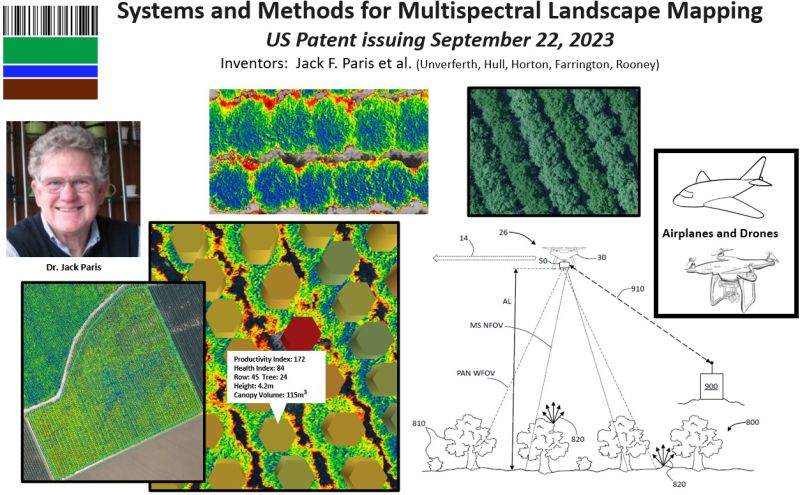
LandScan’s is adding another patent to our growing technology platform. Our comprehensive system combines both the hardware and software necessary to produce the type of high resolution spectral and thermal photogrammetry required for advanced computational agronomy. The technology is for airborne applications (drones and airplanes) because it is not possible to obtain adequate 3D crop hyper-spatial resolution metrics from satellites in orchards, vineyards, or other applications where attributes like plant height and canopy volume are important. The technology has many advantages over LIDAR not the least of which is the speed and rate of data collection.
This patent is just one of the many advancements that LandScan has achieved as a direct result of two company acquisitions made in the past few years (Paris Geospatial and MicroImages). Jack Paris is a pioneer and legend in the remote sensing industry and was a lead developer on many well-known systems including LandSat 1, NASA-JPL, WorldView, PurePixel, and several for the Department of Defense. Mike Unverferth co-founded MicroImages (microimages.com) in 1986 and grew it globally to provide advanced GIS and remote sensing tools to thousands of users in over 120 countries in 24 languages. We are very grateful to Jack and Mike and team for their ongoing involvement in the creation of the world’s first and best digital twin for agriculture.
#ii4ag #digitalvegetationsignature #digitaltwins #digitalagriculture #computationalagronomy #remotesensing

