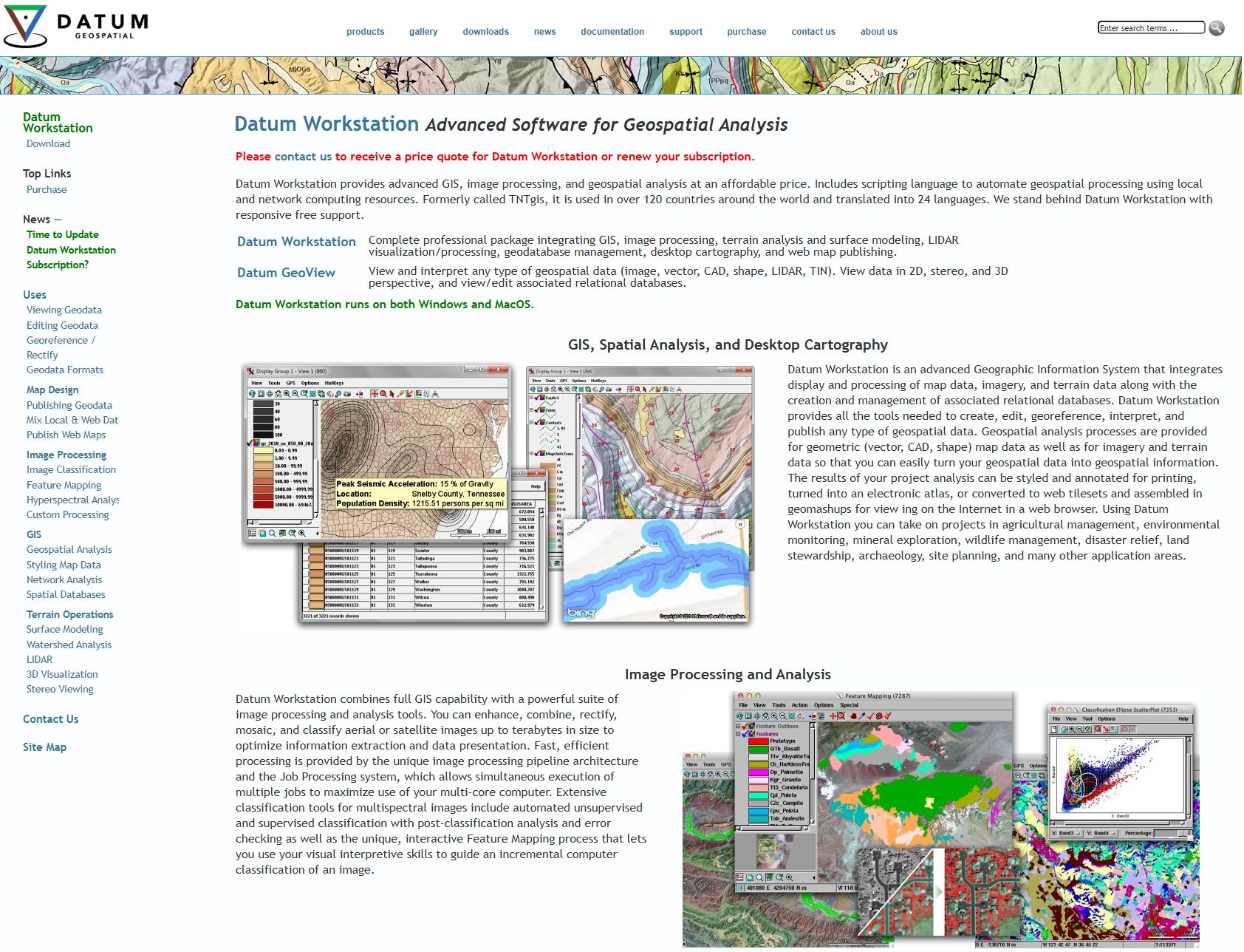
One of the important milestones in the evolution of our hashtag#digitaltwin technology was the acquisition of Microimages in 2021. This is the 40th anniversary of this software that is utilized in 120 countries in 24 languages.
We integrated the powerful remote sensing and GIS tech stack with new cloud-based software and modern AI to create Datum GeoSpatial. Its overall capabilities surpass all other GIS and remote sensing software tools on the market as it includes many of the resource mapping advancements for satellite, drone, and soil mapping technologies developed by LandScan.
Datum GeoSpatial is used around the world on many interesting projects!
➡️ Mosquito behavior model – US Centers for Disease Control & Prevention
➡️ Geological map of Japan – Japanese Geologic Survey
➡️ Coastal map of Bangladesh – UN Land Protection & Reclamation
➡️ Gold exploration – UN Economic Commission of Latin America
➡️ Highway design Ankara- Turkish General Directorate of Highways
➡️ Geological map of Afghanistan – USGS/USAID
➡️ National hydrographic maps – UK and Japanese Hydrographic Office
➡️ Statewide GIS natural resource assets – Maryland DNR
➡️ Soil map of Turkey – Turkish General Directorate of Rural Services
➡️ lots more!
Purchase Datum Geospatial: https://lnkd.in/drWhAbwj
Learn more: https://lnkd.in/emSyFRMg
Potential resellers reach out: https://landscan.ai/
hashtag#GIS hashtag#resourcemapping hashtag#remotesensing hashtag#agtech