Introducing the LandScan Digital Vegetation Signature (DVS). Remote sensing applications in agriculture and forestry are ubiquitous. Everyone it seems has a sensor mounted on a drone, airplane, or ground-based vehicle and satellite imagery is widely available to all. This has led to pervasive claims of the analytical power of these tools, claims that are almost impossible for even the most adept plant or data scientist to discern. This leads to widespread misuse and misunderstanding. The focus is increasingly on spatial, spectral, or even thermal resolution. While these types of resolutions are of course important, the resulting imagery products are becoming commoditized. They are interesting and fun to look at, but how useful are they analytically?
I have had the opportunity to learn about remote sensing from the best. While at the University of Wisconsin-Madison, obtaining my PhD in remote sensing (Environmental Monitoring as it was called back then), I was able to teach the digital image processing laboratory, and sometimes the lecture, for Tom Lillesand, the guy who literally ‘wrote the book’ on the topic. This was the late 90’s and the focus then was on satellite imagery. Agricultural applications for remote sensing at the time consisted of images of corn, soybeans, wheat, and other ‘Midwestern’ crops where there was a late-season closed canopy. This was the perfect environment for satellite imagery, mostly Landsat, where large 30-meter pixels were adequate.
Over a decade later, around 2010, remote sensing techniques developed for satellite imagery began to be applied to airborne sensors. Airborne sensors do not have the automatic spectral calibrations that are built into satellite-based sensor systems. This disconnect was difficult to notice when applied to row crops so long as it was late enough in the season and the vegetative canopy was closed. However, if these techniques were utilized before the canopy was closed, or were applied to crops without a closed canopy, the breakdown became more apparent. If you look down at vineyards, orchards, or early season row crops you see shade, soil, cover crops, and other features that increase the ‘noise’ in the imagery. Starting with various types of soil-adjusted vegetation index formulas, the effects of soil between and under the crop on the vegetation index was recognized. Nevertheless, NDVI became the most popular way to characterize the vegetation. The paradigm of satellite remote sensing had become inadequate for airborne systems.
This realization led to the creation of the PurePixel information product in 2011. My team, led by Dr. Jack Paris, developed PurePixel as a way of ‘cleaning’ airborne imagery to account for, and remove, noisy pixels. This opened doors, and exposed pathways, for new applications in remote sensing. In 2013 Trimble acquired the PurePixel technology where it still resides today, but just like everything in technology a decade is a very, very long time. The industry is ready for the next generation of remote sensing products.
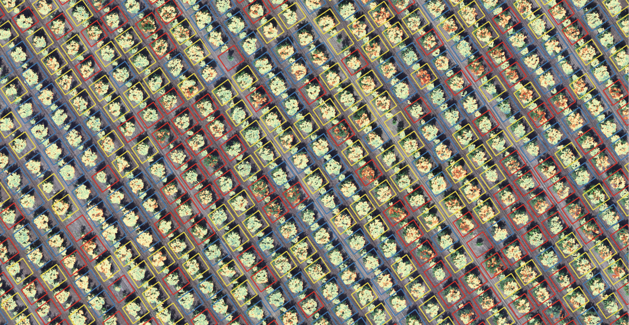
Another decade has passed, and another practice derived from satellite remote sensing applications has created more noise and confusion in the industry. This time the culprit is temporal resolution, that is, the utilization of remote sensing to assess changes in vegetation over time. Now the industry has added drone-based imagery to the mix, but really the line between drones and airplanes will become indistinguishable as laws and practices applied to drones will mean that unmanned and eventually autonomous airborne systems will be the norm in agricultural and forestry applications. Advances in technology means that these airborne systems now may include LIDAR, geomagnetic, microwave, thermal, and of course better spectral sensing capabilities. These new sensing technologies are a fantastic addition to our industry for single snapshots in time.
Unfortunately, every current example of airborne analytics in the industry is lacking the spatial and spectral calibrations required to produce temporal analytical quality data. Airborne sensor data is being misused again, and it is nearly impossible for the unknowing executive, analyst, or analytical system to distinguish between noise and reliable data. You simply cannot ‘stack’ time series data with airborne sensor systems like you can with satellite imagery.
LandScan has spent the better part of the past 30 months focusing on solving this problem, and we have succeeded. The Digital Vegetation Signature (DVS) technology has been developed to enable true temporal analytics in airborne remote sensing. The DVS unlocks an entire new set of information dimensions to be used for vegetation evaluation and analytics. The DVS can now see what other technology cannot, and we are very excited about this!
We encourage you to follow along in 2022 as LandScan deploys the DVS on numerous research sites. When used as a guide for the deployment of the Digital Soil Core (DSC), the DVS creates a unique connection between plant performance and behavior and the growing environment, and a true digital twin for agriculture. Both the DSC and DVS work together to power LandScan’s Platform for Discovery that produces information infrastructure for agriculture.
LandScan.ai
