Merry Christmas!
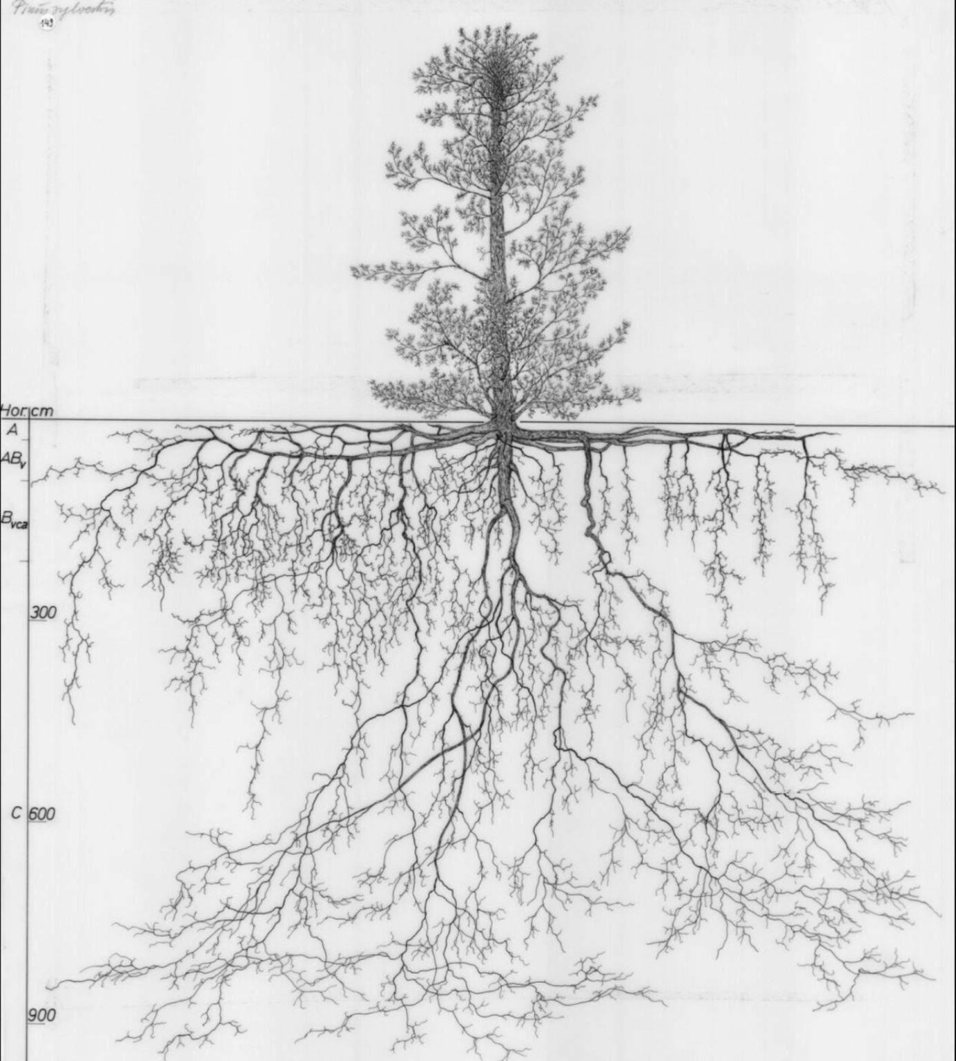
Merry Christmas…and remember more than half of the plant (crop) is underground. Enjoy our Christmas Haiku. Merry Christmas treeMajestic in sky and soilSo much to explore
Merry Christmas…and remember more than half of the plant (crop) is underground. Enjoy our Christmas Haiku. Merry Christmas treeMajestic in sky and soilSo much to explore
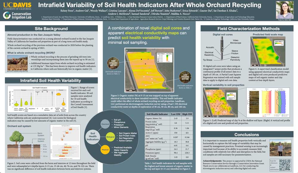
LandScan’s Digital Soil Core was used to characterize soil health indicators across a young almond orchard in the San Joaquin Valley after whole orchard recycling as part of a UC Davis study. A poster about our work was presented at the Fall 2022 conference of the American Geophysical Union. See the full poster here. Thank
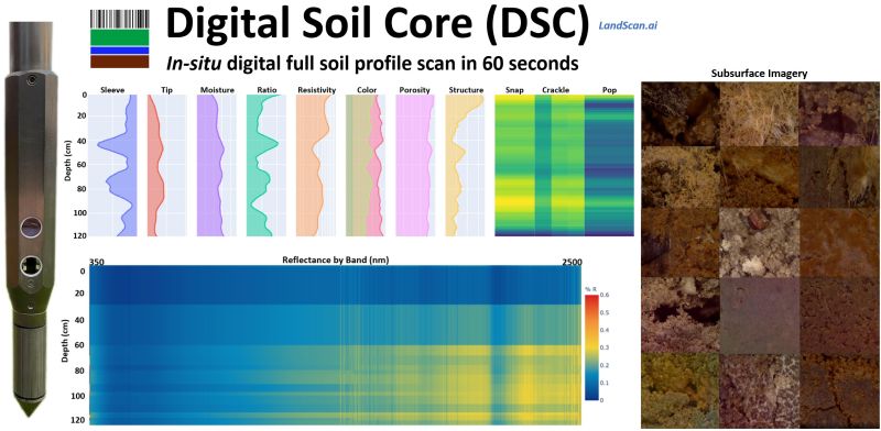
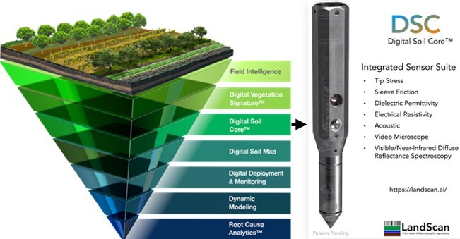
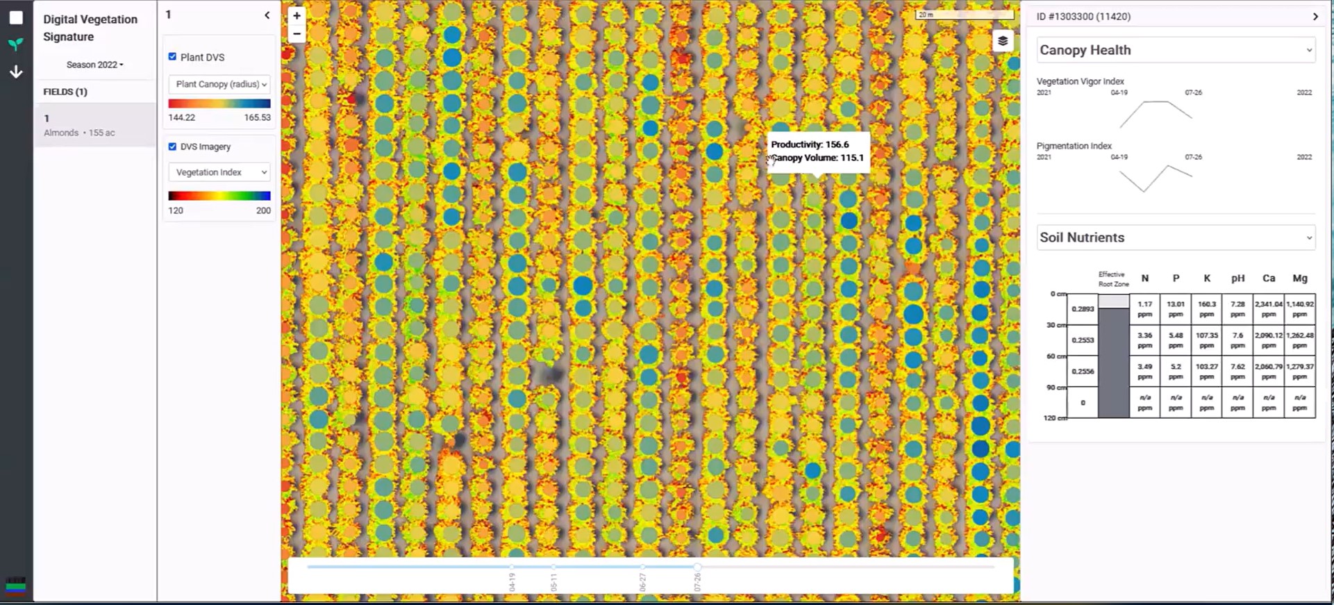
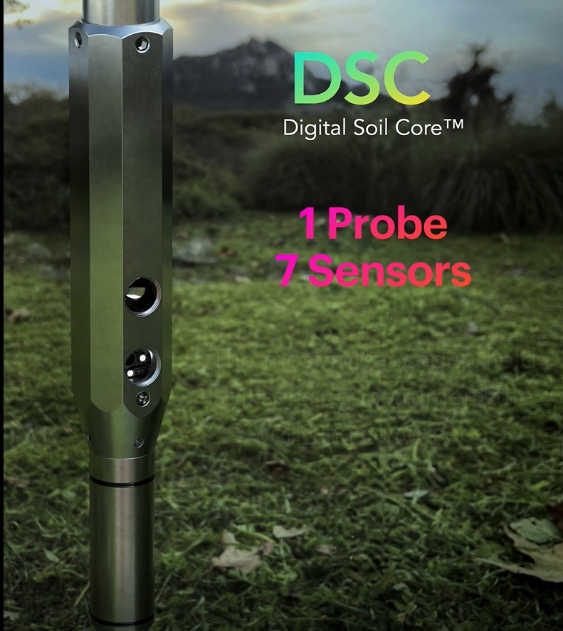
The crop is scanned using quality imagery #digitalvegetationsignature which in turn is used to guide the location of the #digitalsoilcore (DSC) observations. The DSC’s 7 independent sensors obtain an objective, in-situ, continuous digital soil profile to 120cm+ in about 60 seconds. Hundreds of observations can be taken in a single day. This includes a full
LandScan and especially the Digital Soil Core (DSC) team would like to recognize #worldsoilday and thank all of the teachers, scientists, engineers, and data analysts who went before us. We are standing on their shoulders. There is an accelerating recognition that soil is at the foundation of our food systems and environmental stewardship. The #digitalsoilcore
Learn more: https://landscan.ai/platform/digital-soil-core/ #digitalsoilcore #ii4ag #digitalagriculture #digitaltwins
Several people in my network have directed me to this publication in the past week wondering why it seemed to leave out any reference to the Digital Soil Core (DSC).
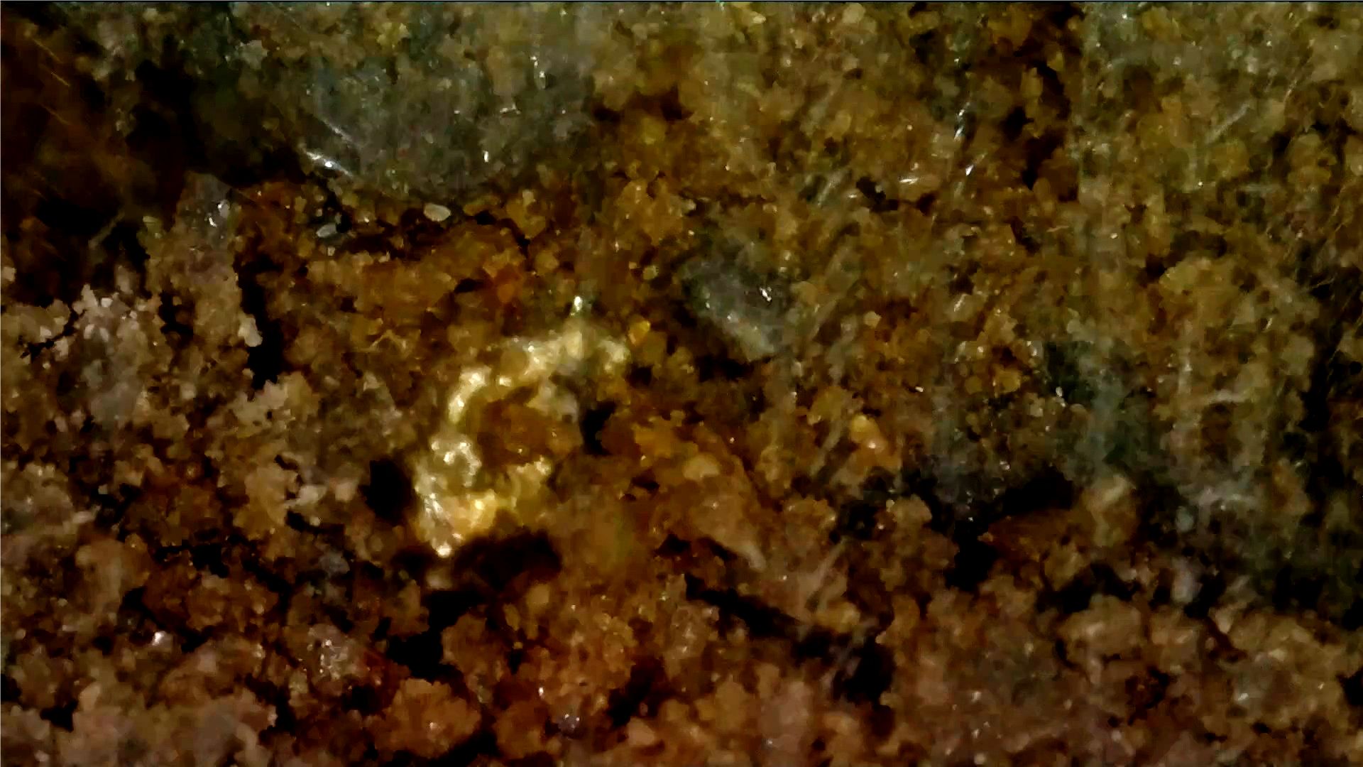
Eureka! (?) We are often asked about utilizing the Digital Soil Core (DSC) for mineral exploration. We are seeing what looks like gold at some depths in certain locations and at this location there was quite a bit of this material. Doesn’t seem to be pyrite. Learn more about the DSC here: https://landscan.ai/platform/digital-soil-core/ #digitalsoilcore
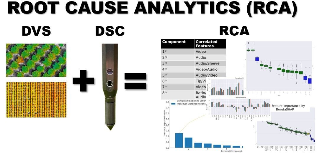
The Digital Soil Core (DSC) has changed the way soil is characterized by providing rapid, digital, objective, repeatable, and transferable metrics of the complete soil profile in about 1 minute. The real power of the DSC comes from the synergies derived from having 7 independent sensors. Each sensor modality is orthogonal to the others, maximizing
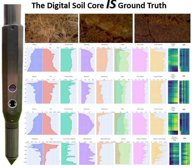
What is your truth? Ground truth that is… The Digital Soil Core (DSC) is the only soil sensing technology in the world that completely ‘senses’ the soil…the DSC feels, sees, hears, and to some extent smells and tastes the entire soil profile. Learn more about the DSC and how we use it from other LinkedIn
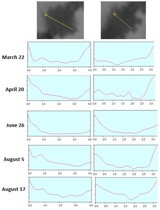
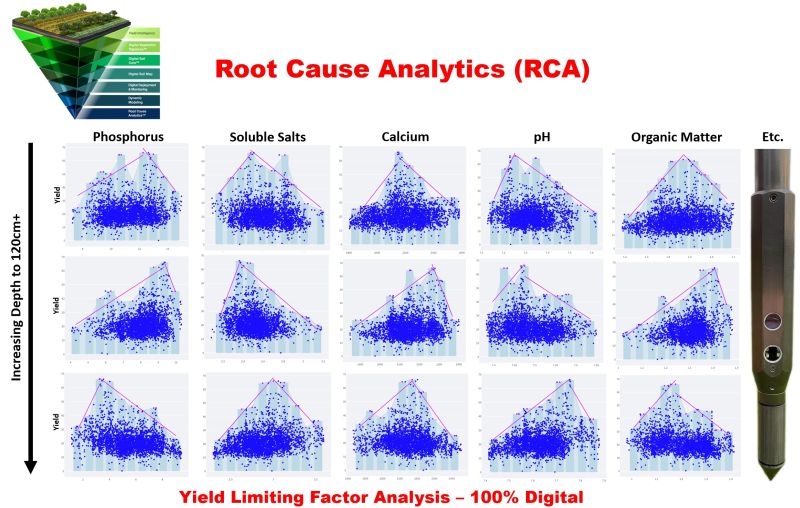
Characterizing and classifying vegetation is a hot topic! The Digital Vegetation Signature (DVS) includes a high-precision thermal sensor that enables LandScan to add this important ingredient into our Root Cause Analytics (RCA) tool. The two trees are not distinguishable from each other in March or June, but their differences are obvious in April and August.
Thank you Tim Hammerich for taking the time and giving me the opportunity to speak to the industry via your podcast The Future of Agriculture! #ii4ag #digitaltwins #digitalagriculture https://overcast.fm/+a-BVe0eiM
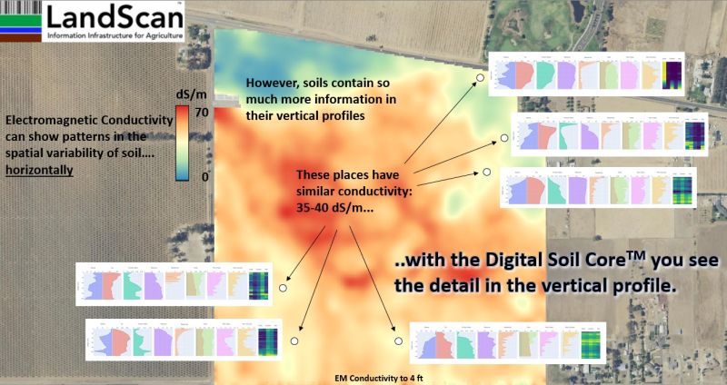
Beware of shifting sands! There are many who utilize EM/EC sensors to produce ‘soil maps’. These sensors do not produce soil maps and are almost always ‘oversold’ as such. The providers utilize the patterns generated from these sensors to interpolate and extrapolate their soil observations along with topography and/or yield making the false assumption that
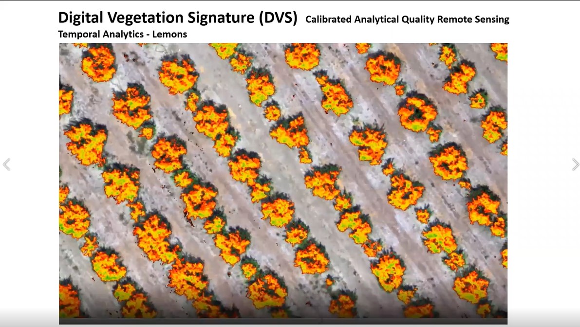
It’s about time! You can’t do advanced analytics in agriculture without a digital twin. Analytical quality remote sensing data provides an entire new dimension of information for advanced temporal analytics. The data must be calibrated at the pixel scale. LandScan does this with the DVS in 3 data dimensions: 7-band multi-spectral, hyper-spatial, and thermal. This
Do you want to see something revolutionary for the first time? We call it “Information Infrastructure for Agriculture”. Remember, if you can’t measure it, you can’t manage it. This product brings together many elements starting with a group of intelligent, hard-working, team members who designed and developed the Digital Vegetation Signature (DVS) and Digital Soil
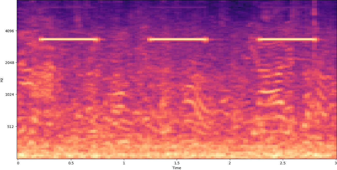
We call it the “Snap Crackle Pop” sensor, but it is really a cleverly engineered listening system that collects and analyzes the complex audio signals created as the Digital Soil Core (DSC) is inserted into the soil. The many incredible rich information dimensions obtained with the audio sensor are fused with data collected from the

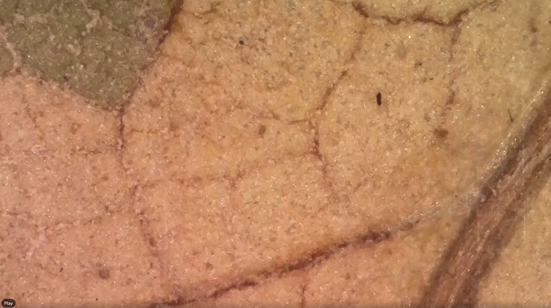
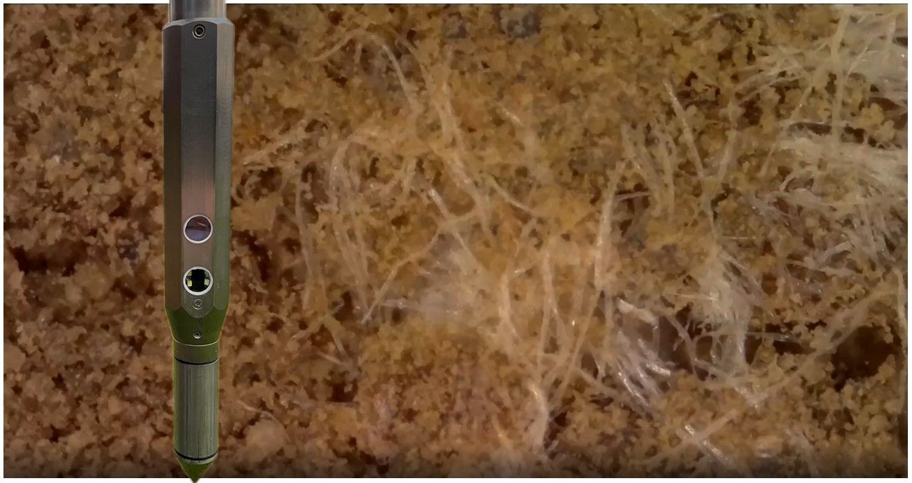
Every day we see so many amazing features in the soil that relate to soil health and the soil microbiome. Here we see a network of fungal hyphae mixed with root hairs. The spatial resolution is about 3 microns the image scale is 2.3mm x 1.3mm. The Digital Soil Core (DSC) contains 7 sensors that
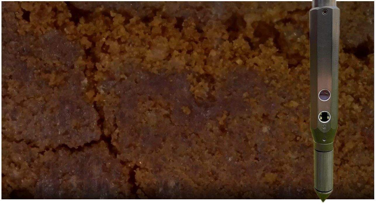
The Digital Soil Core (DSC) passing by a leaf buried in the soil. #ii4ag #digitalsoilcore
I have been conducting industrial field-scale agronomic research for over 3 decades. One thing that became crystal clear to me is that the soil is the driving factor in how a crop performs and behaves over time at any given location within a field. Canopy volume has been shown to drive light interception and yield
Let the Digital Soil Core (DSC) take you back to your roots! The possibilities are endless and there is so much to discover. Every day LandScan is uncovering never-before observed in-situ relationships between plant performance and behavior and the growing environment. The digital video microscope is paired within the DSC with other sensors that add
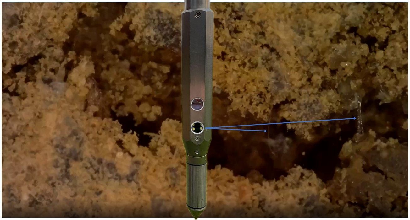
The Digital Soil Core (DSC) is breaking new ground! We see water beading across void space and root hairs at 65cm along with many other features in today’s scene. The digital microscope is one of 7 sensors contained within the DSC that is revolutionizing subsurface characterization and enabling advanced analytics. #digitalsoilcore #ii4ag #soilhealth #digitalagriculture
They say that structure is the Holy Grail of soil properties. Drink up! The Digital Soil Core (DSC) obtains a real-time, in-situ, continuous vertical soil profile in a little more than a minute that can be viewed anywhere in the world as it is collected! The cool part is that you cannot acquire this content
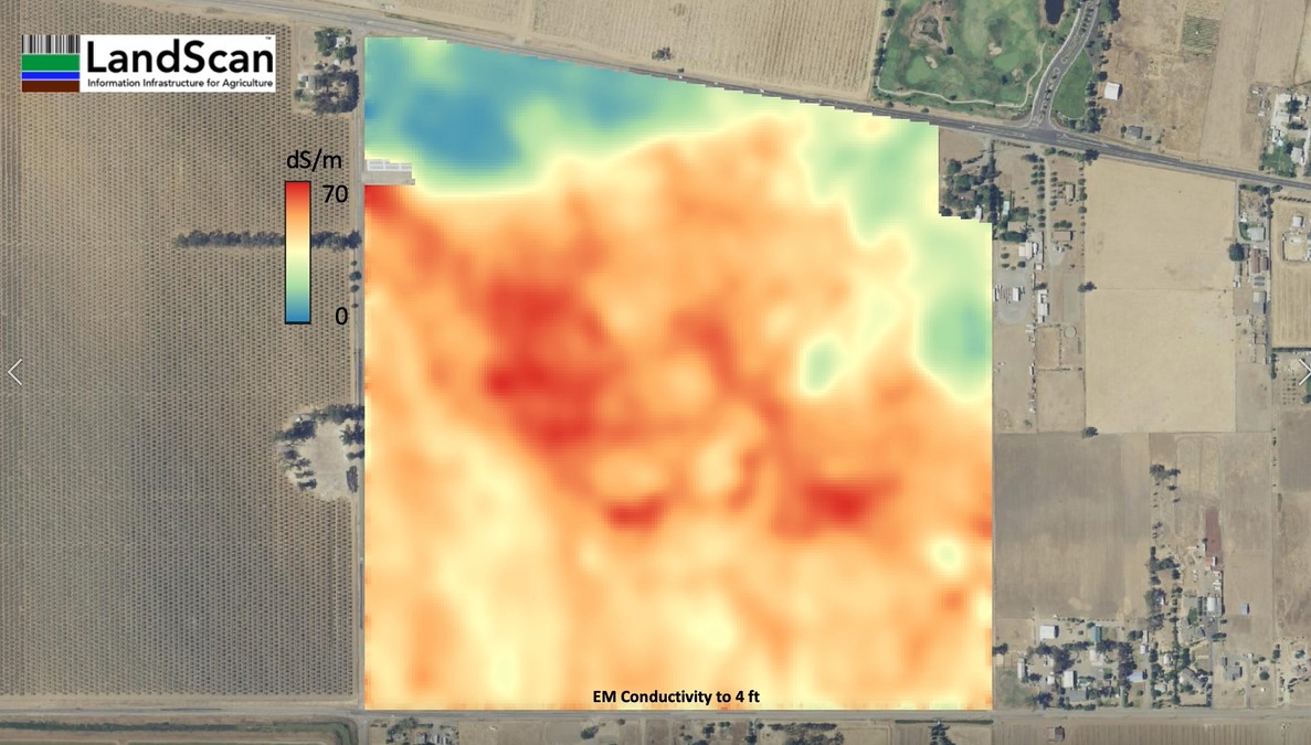
Don’t be fooled by colorful maps and fantastical claims! The Digital Soil Core (DSC) will expose the ‘ground truth’… Electromagnetic conductivity (EC) data sets are useful and are one small part of LandScan’s site characterization process…but they are not soil maps. The same conductivity measurement is almost always a result of multiple soil properties measured
So many dimensions in so little time. Let the discoveries begin! Informative and unique information products are being created from the Digital Soil Core (DSC) for our 2022 test sites. The DSC generates a continuous vertical soil profile from 7 sensors at a rate of about 2 cm/sec. The DSC is part of the LandScan
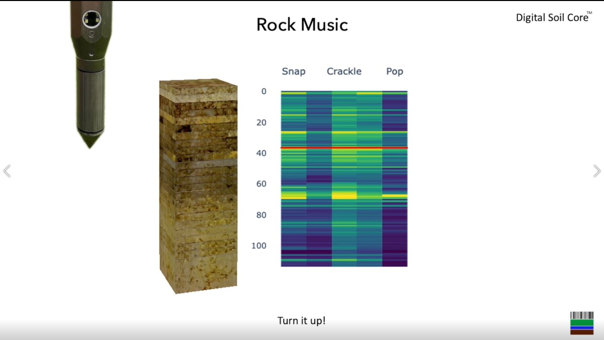
LandScan is now making rock music! The Digital Soil Core (DSC) #digitalsoilcore contains 7 sensors. One of these we call “Snap Crackle Pop” and it is a highly sensitive and tuned acoustic sensor capable of delineating coarse fragments and providing additional information about other soil physical properties. This sensor adds an additional set of information