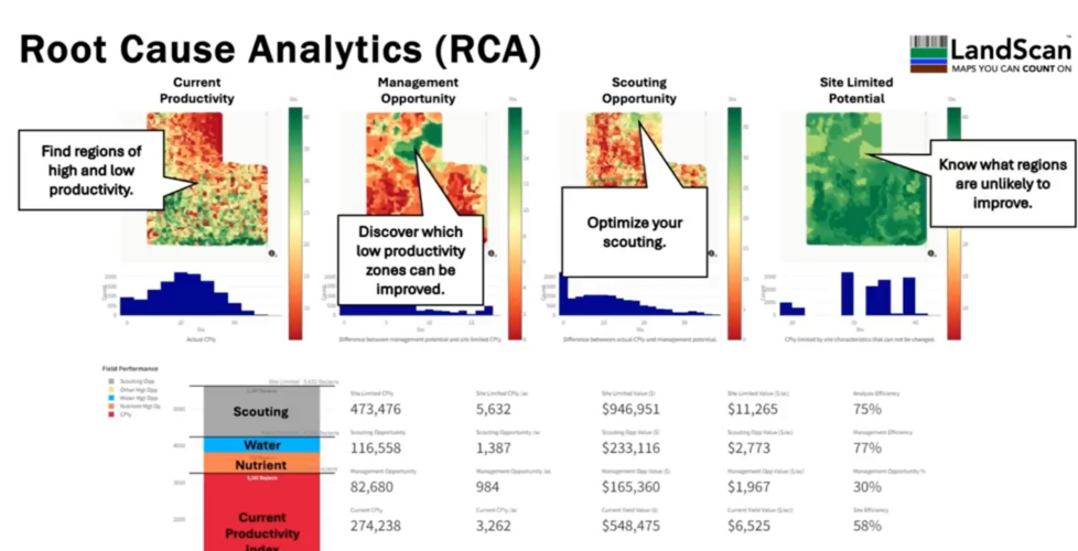
The Next Frontier in Soil Health: Building a Digital Twin of the Soil Microbiome for G.E.M. Analysis
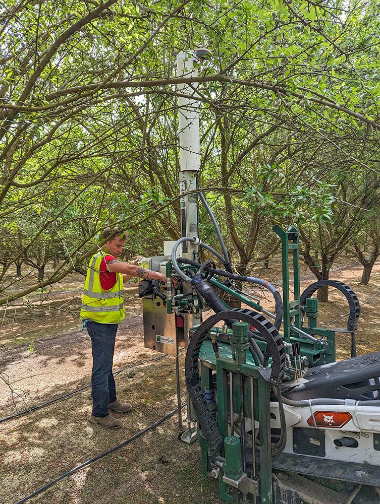
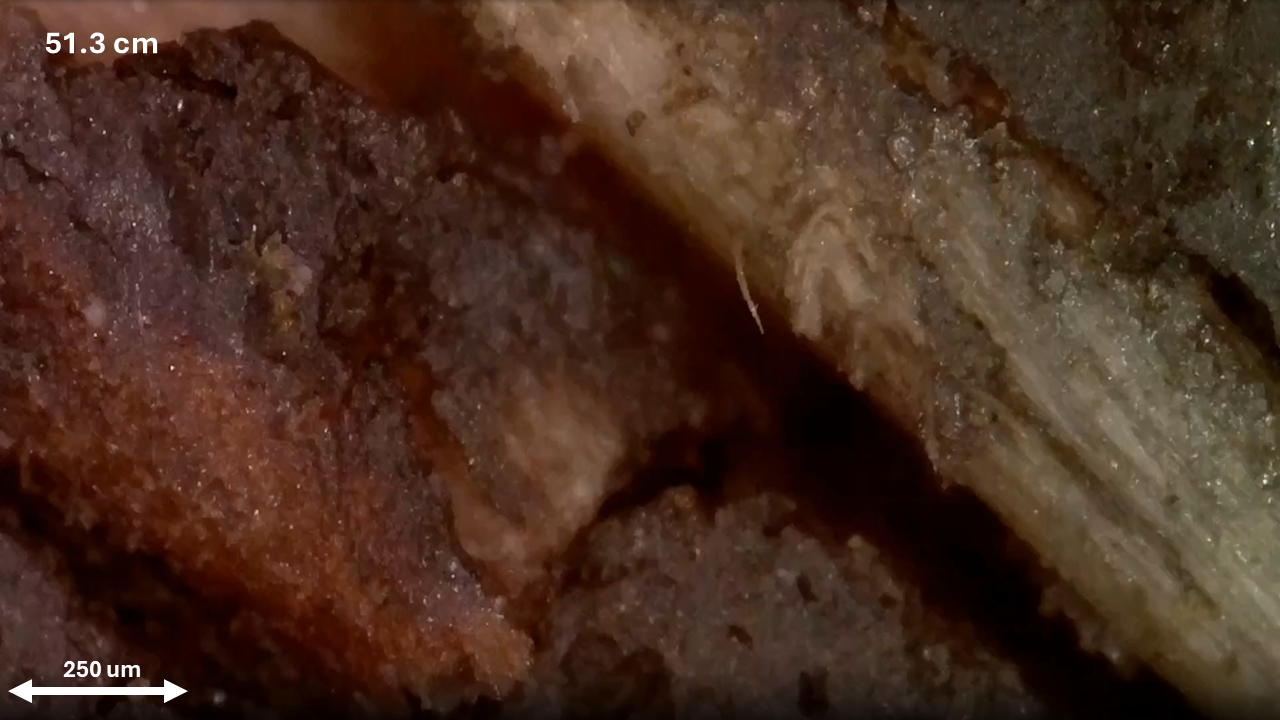
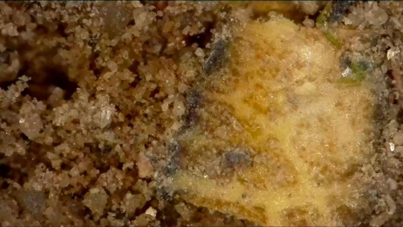
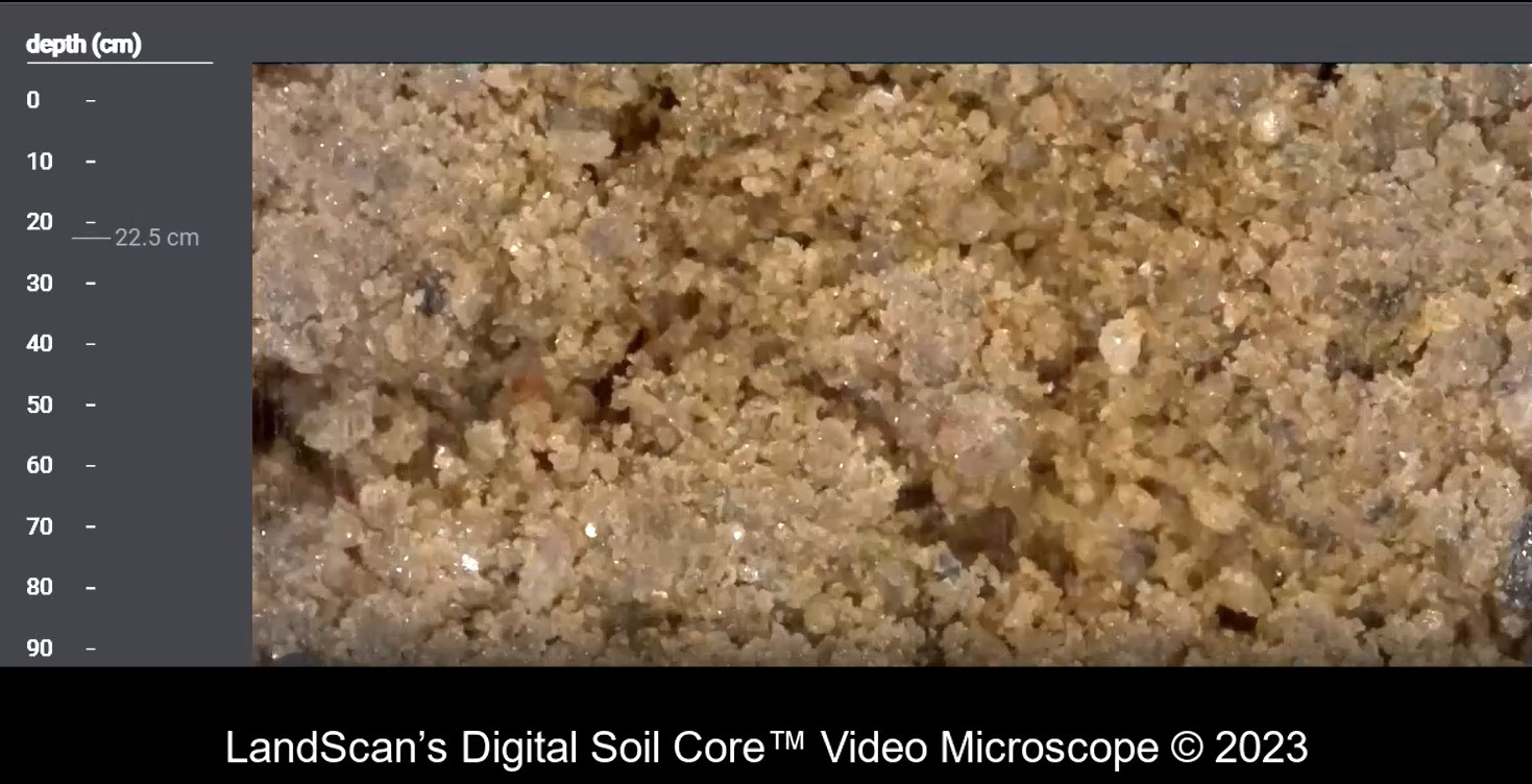
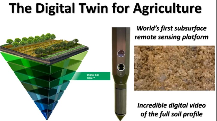
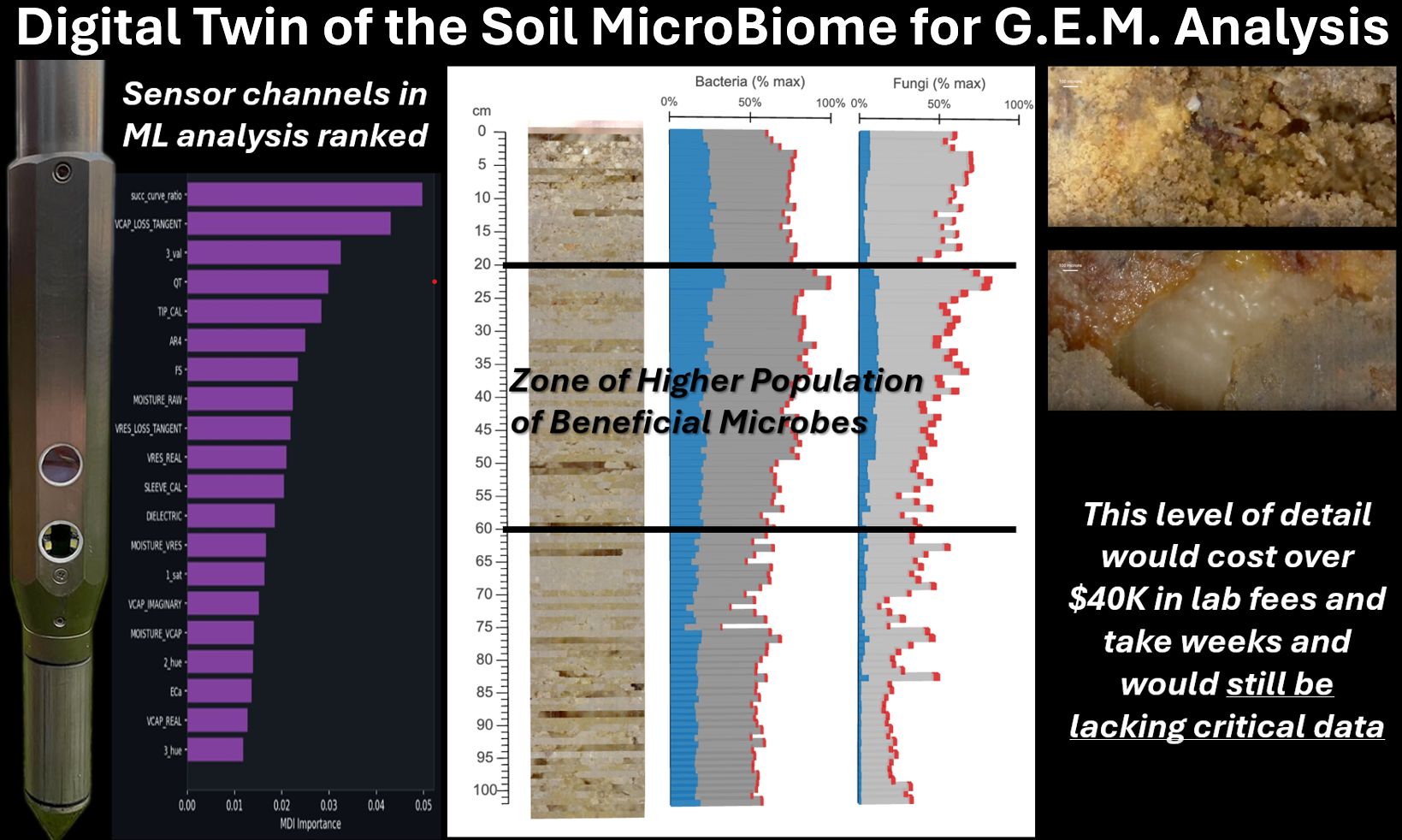
Our team has created the first ever digital twin of the soil microbiome for G.E.M. analysis. Objective and rapid scans of the entire soil profile trained using the hashtag#digitalsoilcore sensors and deep machine learning to predict and quantify the soil micro-biometric environment and populations. More than a century ago, Dutch microbiologist Martinus Beijerinck helped frame